


")
")
EXPLORE AERIAL PHOTOS (DRONE)
PROJECT AREA SURVEY WITH DRONE
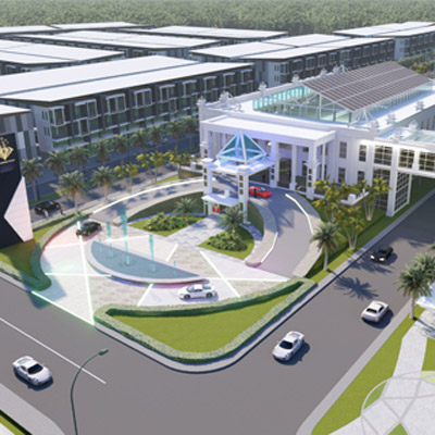
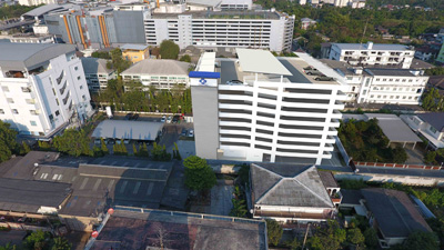
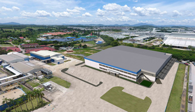
Because of vision It is important for the construction work, whether it is in the design. Or construction management Thais have used technology. Photography dan To help open up new perspectives in exploring the project area. Especially looking from the high angle. This will help our team. See the area. The project area and the environment are realistic. Cover and clear This will allow us to use it as an analytical data. Factors to consider regardless of the size of the real situation. Utilities The environment of Land or building nearby This is important information for Site Analysis, which will let us know. Customer needs, design or vision needs, problems, and plans. To solve the problem from the beginning of the design. And even during the construction of the project. The project area is wide. It makes the team. Analyze all obstacles and obstacles. Planning for the construction. It's going to be even faster. In addition to the Presentation Presentation, the Thais also use the photo. Bring the real space image. 3D Photo Building Presented in Bird View View to help customers visualize the most realistic frameworks. At present, there are many innovative technologies. All in all, the quality and time to work faster. Our team will not fall for the trend and continue to seek. New techno This will allow us to optimize our work both in quality and time. Our customers are assured of the best of our services.
EXAMPLES OF IMAGES AND VIDEOS FOR SURVEYING PROJECT AREAS WITH DRONES
Our team will not fall trend and continue to seek New Techno That will help our work to increase efficiency both in quality and time So that our customers can be confident that they will get the best from our services
Used in surveying project areas and making maps.
Take a picture for retouch at the actual location.
Take photos during construction and update construction progress.